Story Highlight
– Snow and ice warnings issued across large UK areas.
– Health alert in effect for central and northern England.
– Road closures reported due to concentrated snowfall.
– Heavy snow expected over high ground this weekend.
– More rain and strong winds predicted next week.
Full Story
The Met Office has proactively issued additional warnings for snow and ice, affecting a considerable portion of the UK this weekend. Alerts are active for parts of northern England and Scotland, while separate cautions regarding ice are in place for a broader area that includes much of England and Wales.
These warnings were initiated between 4pm and 8pm on Friday and are projected to extend into Saturday. A more specific snow and ice warning for northern regions of England and Scotland began at 9pm on Friday night and will persist into Saturday morning. According to the forecaster, there is potential for heavy snowfall which could disrupt travel plans, especially across elevated regions, during Saturday evening and into Sunday morning.
The weather service has urged residents to check local forecasts to stay informed about conditions in their specific areas.
In addition to the snow warnings, the UK Health Security Agency (UKHSA) has issued a cold weather alert, which commenced on Friday and is effective until 8am on Monday. This announcement particularly concerns central and northern regions of the UK. The UKHSA has cautioned that vulnerable populations may face increased health risks and there could be “minor impacts” on health services due to heightened demand.
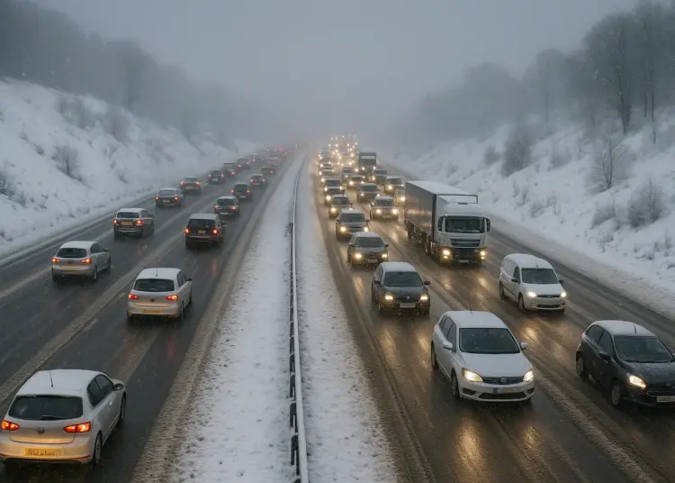
Cold conditions have already resulted in road closures across northern England. Notably, the A66 has been shut between Bowes in County Durham and Brough in Cumbria due to significant snowfall. National Highways has reported that crews are actively deployed, utilising winter treatment vehicles to rectify the situation, although forecasts predict ongoing snow in the area throughout the morning.
The Met Office explained that the current frigid conditions have been brought about by an Arctic maritime air mass. Looking ahead, a new weather front is expected to sweep in from the west on Sunday, bringing further rain, strong winds, and snow that will particularly affect northern sectors of the UK. The Met Office provided insights on the anticipated weather: “Outbreaks of rain spreading eastwards on Saturday night will fall as snow initially, even to low levels for a time, before becoming confined to higher ground as milder air arrives from the west.” Local accumulations of snow could range from 1 to 3cm at lower elevations, while areas above 150m might see 3 to 7cm, and those above 400m could receive between 10 to 15cm.
Ice is another concern, particularly in northeast England and sections of Scotland, where instances of rain could impact frozen ground, leading to hazardous and “very slippery” conditions. Chief forecaster Rebekah Hicks indicated that further warnings could be necessary and advised the public to remain attentive to updates regarding the weather situation. She mentioned, “Snow is likely ahead of the rain across northern England and Scotland and could reach lower levels at times Saturday night into Sunday.”
As the week progresses, rain is anticipated to return on Monday and is expected to continue into the latter half of the week, further contributing to ongoing inclement weather. The start of 2026 has been marked by a series of dreary, wet conditions attributed to a “blocking pattern.” The Met Office reported that 26 weather stations recorded new monthly records for rainfall in January, underscoring the severity of the weather this year. Northern Ireland is noted to have experienced its wettest January in 149 years, while Aberdeen recently faced its longest stretch without sunshine since 1957, with zero hours of sun for 21 consecutive days; this trend was finally broken earlier this week.
With these challenging weather conditions continuing, officials urge residents to remain cautious and prepared for potential disruptions while highlighting the importance of monitoring weather updates to navigate the adverse effects expected in the coming days.
Our Thoughts
To mitigate the adverse impacts of severe winter weather as reported, proactive measures aligned with UK Health and Safety legislation should be prioritized. Key lessons include the necessity for regular risk assessments in anticipation of weather-related hazards, particularly in vulnerable and high-traffic areas. The Health and Safety at Work Act 1974 mandates employers to ensure the safety of employees and others affected by their work, which could include implementing weather contingency plans and effective communication strategies for travel advisories.
The incident highlights a breach of the Management of Health and Safety at Work Regulations 1999, which require hazard identification and effective measures to mitigate risks. Additionally, emergency procedures should be enhanced to accommodate sudden weather changes, ensuring road maintenance crews are adequately prepared and equipped for rapid snow and ice response.
To prevent similar incidents, public awareness campaigns about weather alerts and safe travel practices should be amplified, alongside collaboration with local authorities to ensure timely road safety management. Prior planning can considerably reduce risks to public health and safety during severe weather periods.


